Shimla - Kalpa (250km)
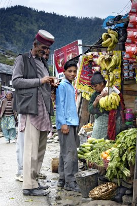
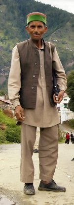
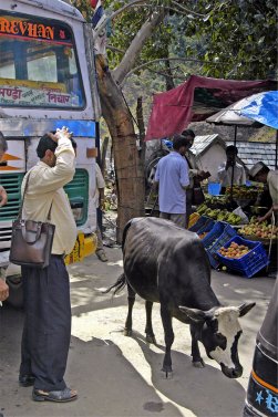
After two nights in Shimla we left in jeeps with drivers from the Spiti valley, and Tsering Dorje, the Principal of the school in Rangrik. We headed east along NH22 towards Kinnaur, a rugged buffer zone between the Shimla foothills and the wild western extremity of Chinese-occupied Tibet. Although visitors are now allowed to travel through the "Restricted Area," and onwards to complete the loop through Spiti and Lahaul to the Kullu valley, a special (Inner Line) permit must first be obtained from Rekong Peo, the district headquarters of Kinnaur. This would be the starting point of the next stage of our travels, but for now our first refreshment stop was Matiana, where the traditional (mostly green) pillbox hats, worn by men and women were typical of the region (pictures either side of this text).
Leaving this village once again tourist-free we climbed over the pass at Narkanda and wound steadily down the south side of the Sutlej Valley. As the river is approached the pine trees thin out and the mountainside grows increasingly sun-parched and bare, except for the rice terraces that swirl in stripes of green and pale yellow around the banks of the roaring milky-grey torrent below.
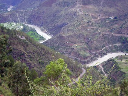
River Sutlej
The main road veers east along the even floor of a grandiose, V-shaped defile towards Rampur, formerly the capital of the princely state of Bhushur. Hidden behind the bustling transport interchange lies the Padam Palace built in 1919 and home of the local ruling family, the Bahadurs, who trace their lineage back 123 generations to Lord Krishna.
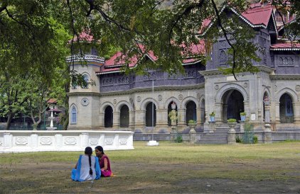
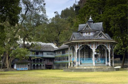
Padam Palace, Rampur
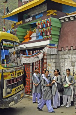
Rampur life!
After lunch in the town we continued along the mighty River Sutlej towards Jeori where the road climbs high above the river, traversing the sheer ravines that run into the valley from the south by means of flimsy-looking cable bridges. Tiny wooden villages, each with a pagoda-roofed temple, cling to the mountain sides - many at gradients which human habitation would seem impossible. At Wangtu bridge the highway switches to the north side of the river where the Nathpa Jhakri Hydro-electric Project – NJHEP is located and derives its name from the names of two villages in the Project vicinity - Nathpa in district Kinnaur and Jhakri in district Shimla. The Project was conceived as a run-of-river type hydro power development, harnessing hydro-electric potential of the middle reaches of the river Sutlej, one of the principal tributaries of the river Indus, in the south west Himalayas. The Project's Dam has been constructed near village Nathpa and its Power House has been constructed on the left bank of the river Sutlej at village Jhakri.
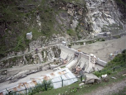
Nathpa dam
The Project stretches over a length of about 50km. from the Dam site to the Power House site and we hit it approaching dusk, in the rain. It felt like a movie set with floodlights illuminating great tunnels, heavy plant littering any spare (!) stretch of road (no longer metalled) and torrents of water being disgorged from way up the mountainside. These conditions degraded an already fragile road (?) into a slithery mess and the drivers were to be praised for keeping the jeeps from slipping into the river, sometimes almost level with us and then way below, as we climbed, by now in darkness, a track at times no wider than the vehicle itself, to eventually reach Kalpa.
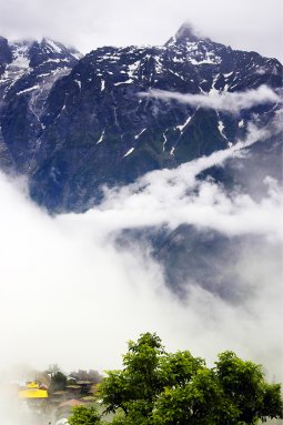
Opposite Kalpa's dramatic location astride a rocky bluff, high above the right bank of the Sutlej, the magnificent Kinner-Kailash massif sweeps 4500m up from the valley floor - a rugged ridge of sharp grey peaks flecked with folds of ice and snow. The mountain in the middle, Jorkaden (6473m) is the highest, followed by the sacred summit of Kinner-Kailash (6050m) to the north, and the needle point of Raldang (5499m) in the south.
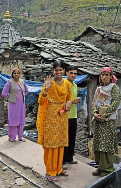
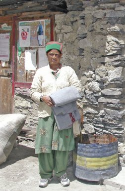
Following our night's rest we moved down the hillside to Rekong Peo to apply for the Inner Line Permits. Many of the women wear traditional Kinnauri garb - a mix of green velvet jackets, heavy home-spun blankets with intricate borders, stacks of elaborate silver jewellery, and caps set at jaunty angles above their long black plaits.
Kinner-Kailash massif Typical Kinnaur dress, Khangi